Skip to content
Foundations – Beta site Logo
Earth Sciences Canada Logo
Canadian Federation of Earth Sciences
  • English
  • Français

SponsorCanadian Geological FoundationPartnerGlenbow Museum

  • English
  • Français

Geoscience Overview

Geoscience Overview
Navigation Page
Sort By Scientist last name
  • Tectonic Terranes of Yukon by the Yukon Geological Survey plus the route taken by Dawson in 1887 in red.

    Explore Geoscience

    YUKON

    Kalzas Range of Southern Yukon

    Tintina Fault; strike-slip motion; Lower Paleozoic Selwyn Basin; Accreted Terranes (micro-plates)

    fieldwork by George M. Dawson

  • Simplified geological map in vicinity of Hopewell Rocks, Castle Cove, New Brunswick

    Explore Geoscience

    NEW BRUNSWICK

    Coastline along Shepody Bay, Bay of Fundy

    Seastacks- Coastal Erosion of Early Carboniferous Coarse Alluvial Fan Redbeds; Marine Evaporites & Limestones of Maritimes Basin

    fieldwork by Abraham Gesner

  • Portion of GSC geological map by Paul Hoffman et al. in Open File 2559 published in 1993

    Explore Geoscience

    NORTHWEST TERRITORIES

    Great Slave Lake Area

    the Slave Craton, Archean Core of North America; World’s Oldest Rocks; Greenstone Belts; Wopmay Orgogen & Ancient Tectonics

    fieldwork by Paul Hoffman

  • Geological Map of Newfoundland by James P. Howley 1919

    Explore Geoscience

    NEWFOUNDLAND

    St. Mary's Peninsula (part of Avalon Peninsula)

    Tectonic Assembly of Newfoundland

    fieldwork by James Howley
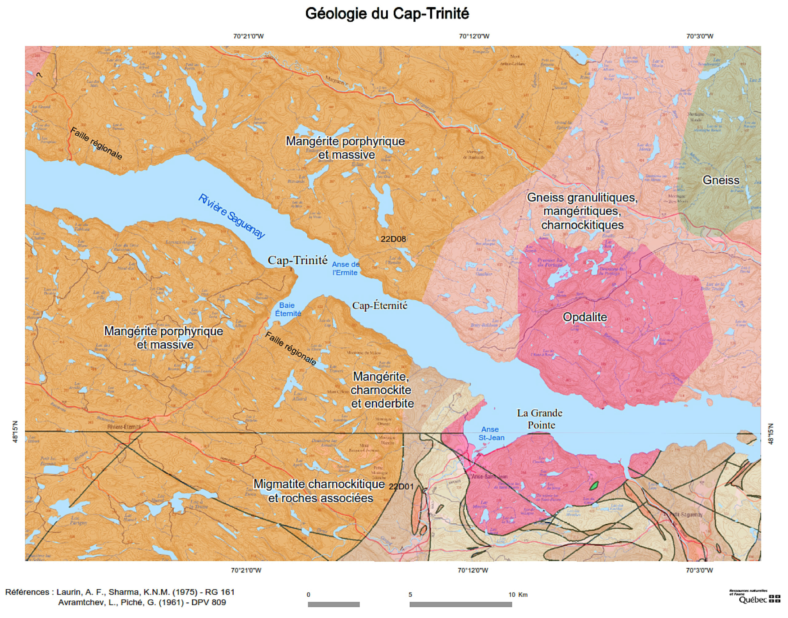
  • Quebec Saguenay River map thumbnail

    Explore Geoscience

    QUEBEC

    Saguenay River Area

    Exposed roots of Precambrian mountains; development of Saguenay Graben; Pleistocene glaciation and isostatic rebound

    fieldwork by Msr. Joseph C.K. Laflamme

  • Quebec Eastern Townships map thumbnail

    Explore Geoscience

    QUEBEC

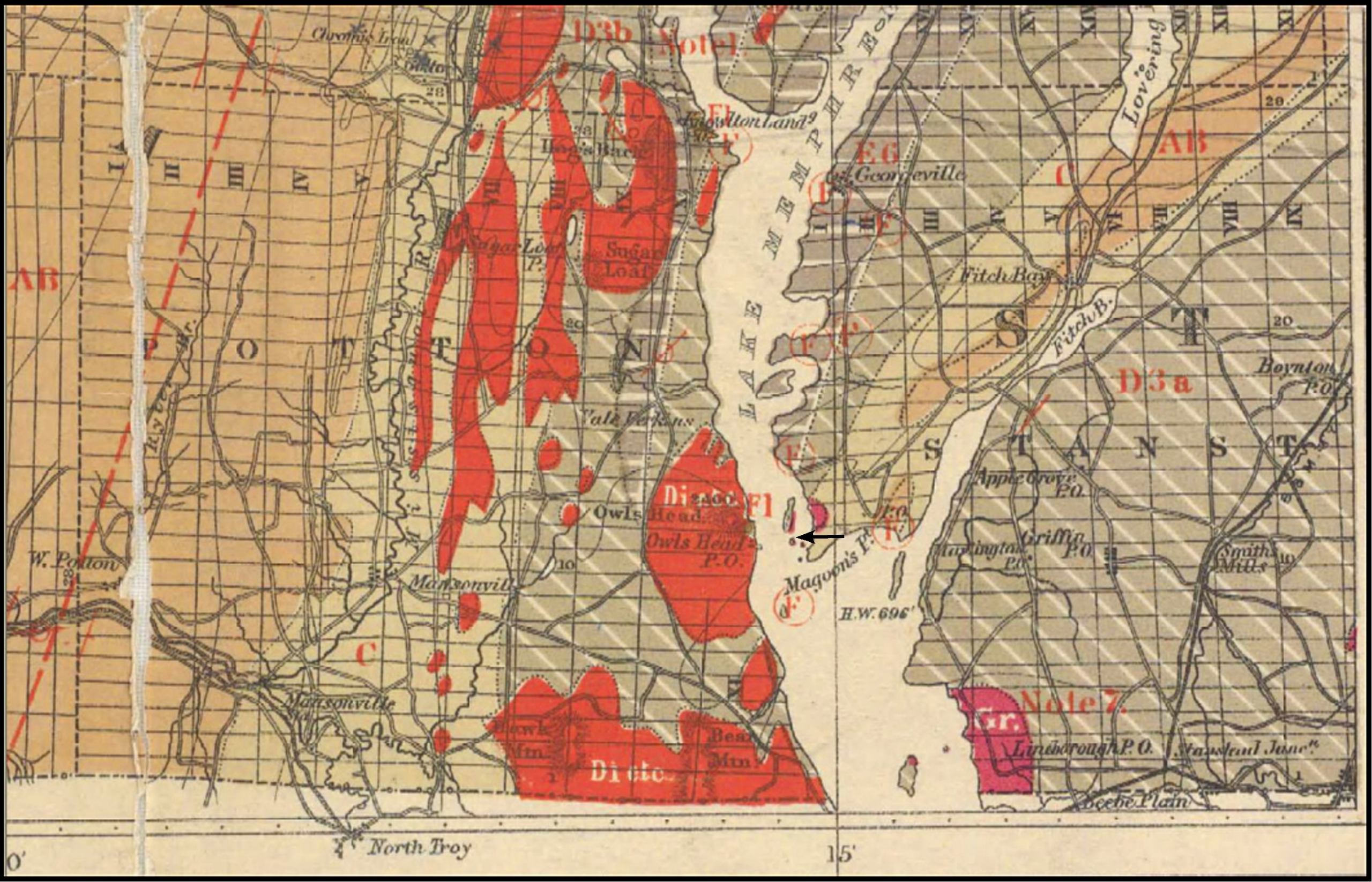
    South-central part of Eastern Townships (Estrie)

    Spillitic meta-basalts associated with accretion during the Taconic Orogeny (closure of Iapetus Ocean)

    fieldwork by Sir William Logan
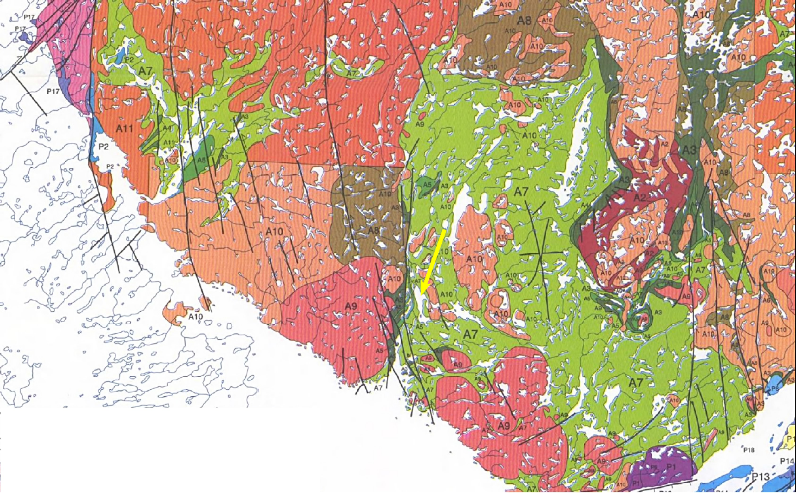
  • Map of metamorphic facies of Bylot Island from Jackson & Berman (2000)

    Explore Geoscience

    NUNAVUT

    Bylot Island

    Archean high-grade meta-sediments, volcanics and granites intruded by slightly younger monzonite (Bylot Batholith)

    fieldwork by Albert Peter Low

  • Portion of GSC map by R.G. McConnell published in 1885

    Explore Geoscience

    SASKATCHEWAN

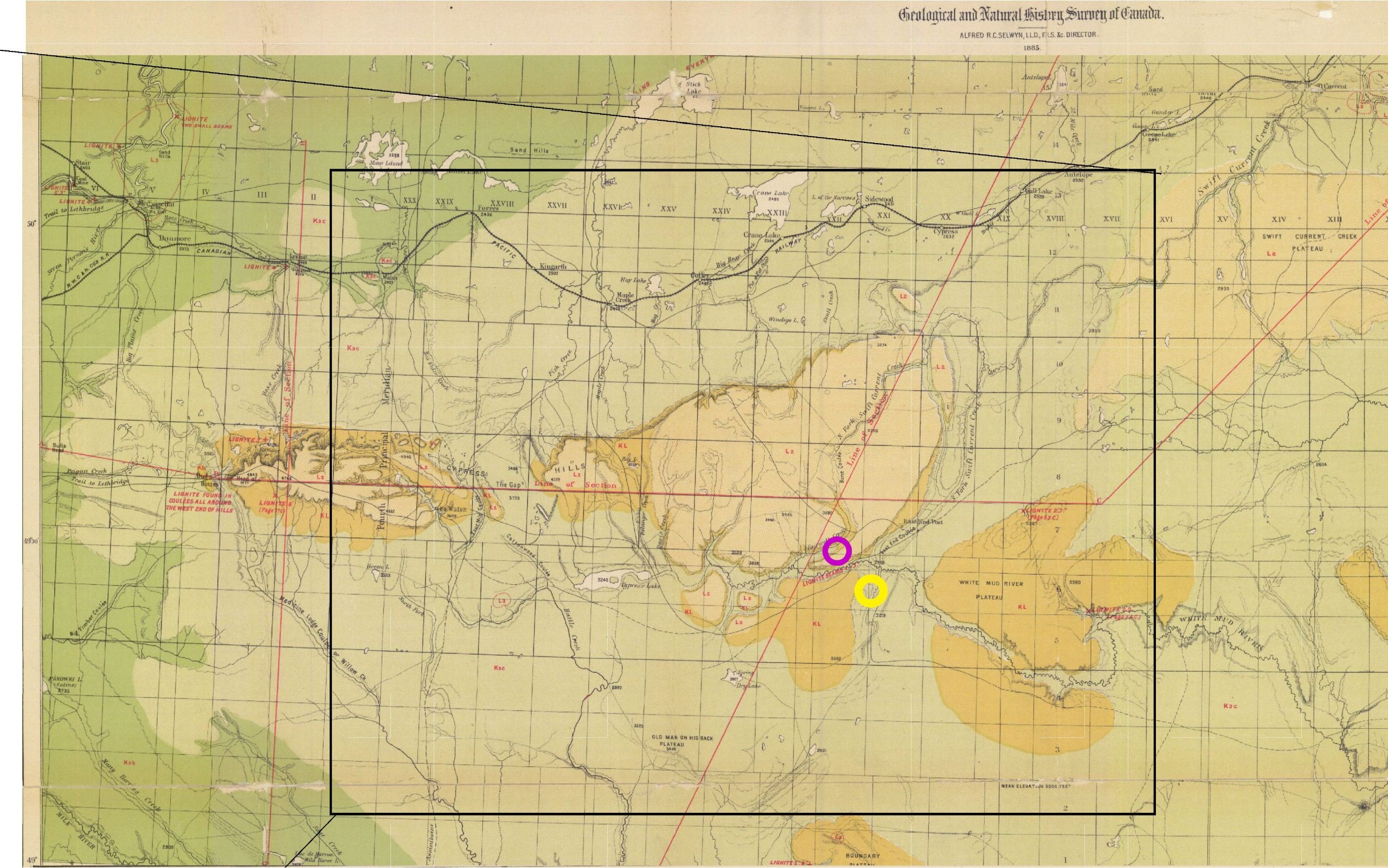
    Southwestern Saskatchewan on Southern flank of East block of Cypress Hills

    Remote Sensing; Cretaceous-Tertiary (K-T) Extinction Event; Dinosaur Finds

    fieldwork by Richard McConnell and Jack Mollard

  • Ontario Algonquin Park map thumbnail

    Explore Geoscience

    ONTARIO

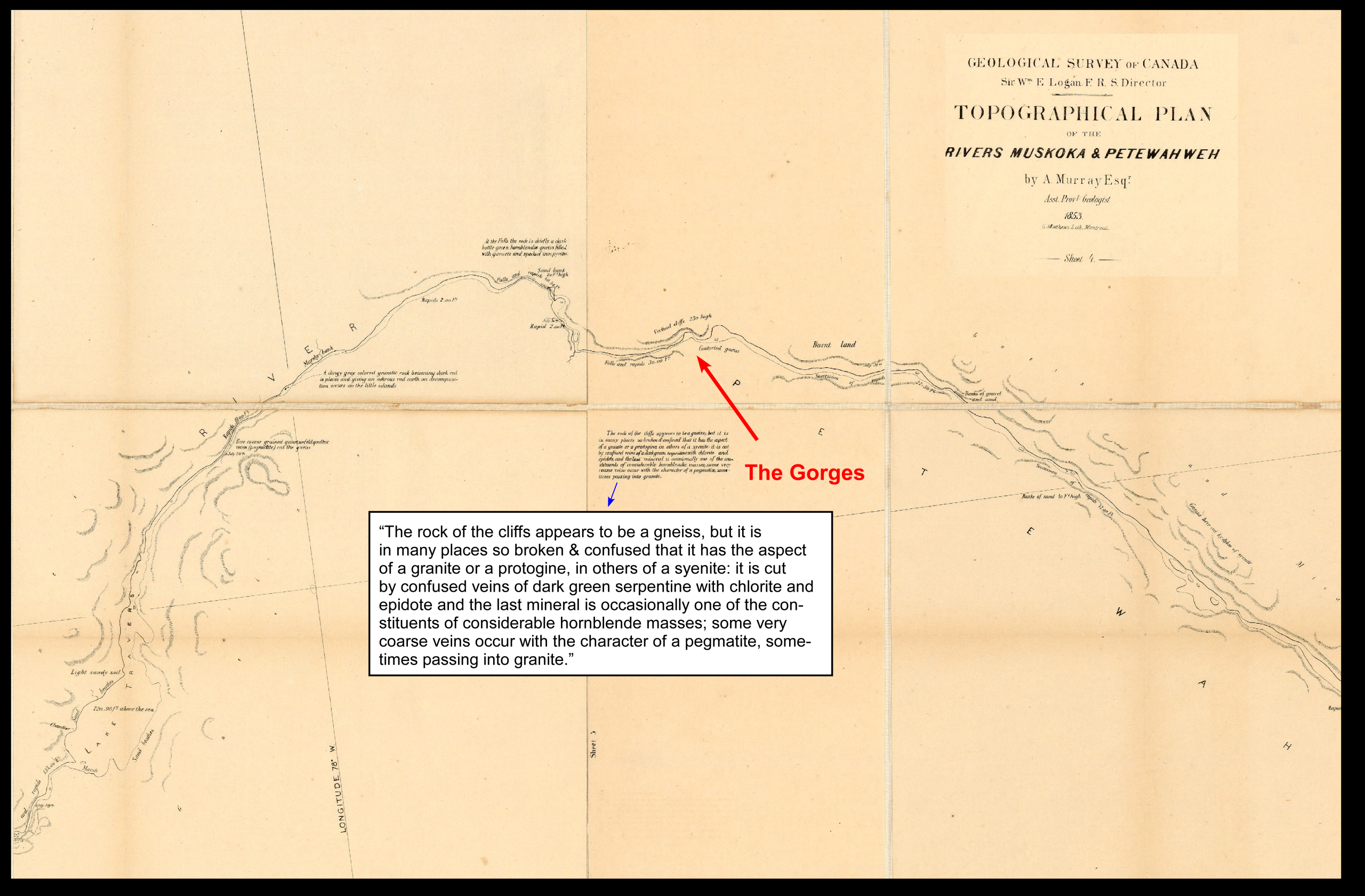
    Northeastern Ontario Algonquin Park

    PrecAmbrian plate tectonics and Pleistocene (Laurentide) glaciation

    fieldwork by Alexander Murray

  • Ontario southern Ontario map thumbnail

    Explore Geoscience

    ONTARIO

    southern Ontario in vicinity of Niagara Falls

    Headward Erosion; Origin of Niagara Falls, Gorge and River; Wisconsin Glaciation

    fieldwork by William Spencer

  • Portion of GSC geological map (Bear Bay West 1614A) of Devon Island by Thorsteinsson (1986).

    Explore Geoscience

    NUNAVUT

    Devon Island in the High Arctic

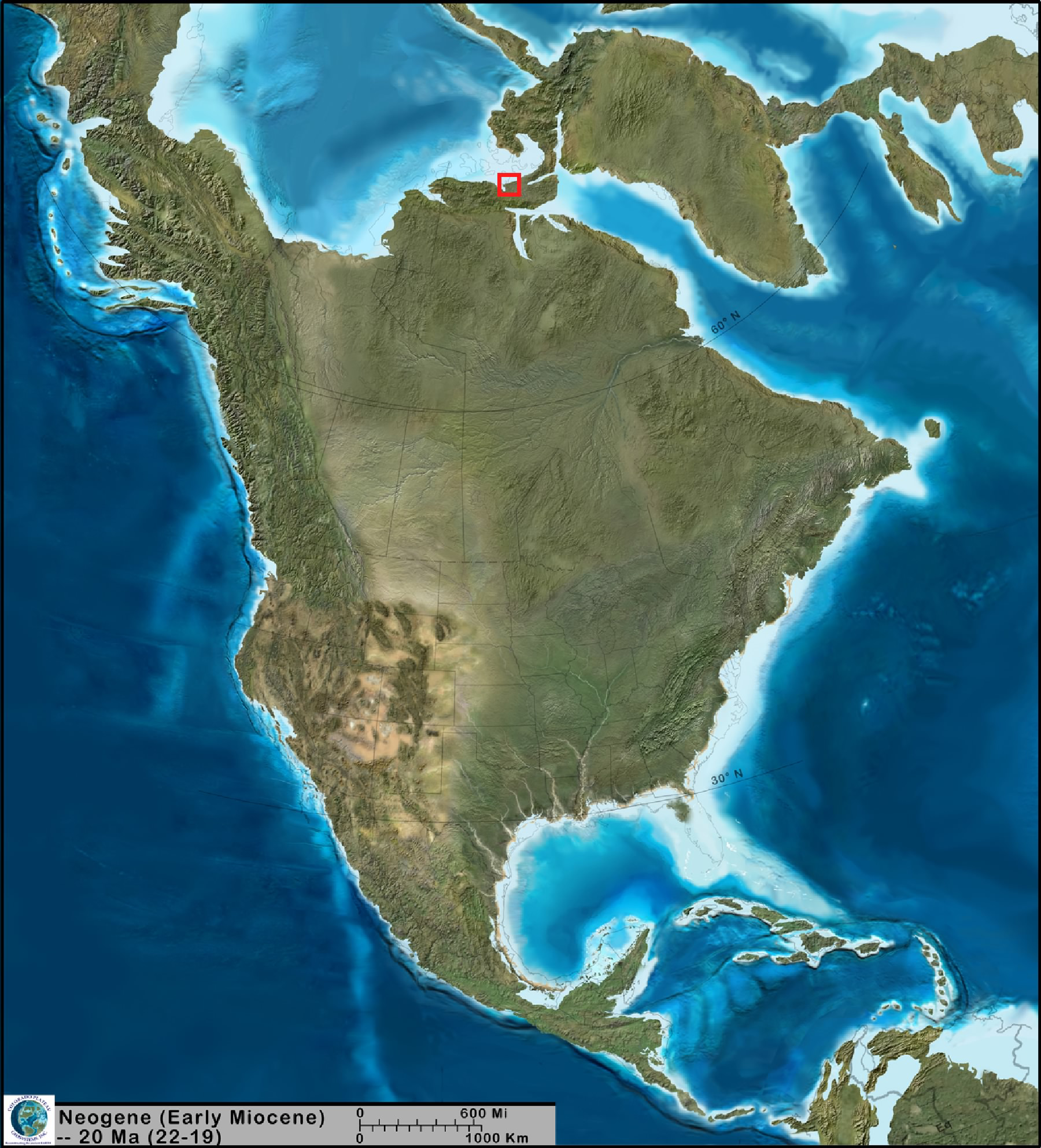
    Meteorite Impact Crater created in the early Miocene; Cambrian to Devonian strata of Arctic Platform

    fieldwork by Ray Thorsteinsson

  • Portion of GSC geological map of Northern Alberta by J.B. Tyrrell (1887)

    Explore Geoscience

    ALBERTA

    Northern Alberta Along N. Saskatchewan River Near Edmonton

    Upper Cretaceous Stratigraphy; The "Belly River" Problem; Coals

    fieldwork by Joseph Tyrrell

Toggle Sliding Bar Area
Page load link

Acknowledgements Modal

Demo Description

The Foundations project has been worked on for many years and has been supported by a number of volunteers and organizations. Without their contributions the website and its content would never have seen the light of day.

Concept and initial reveal to the public

During the planning stages of the  GeoCanada 2010 convention in Calgary, the Canadian Federation of Earth Sciences, the newly formed umbrella organization that had arisen from the ashes of the Geoscience Council of Canada, wished both to engage the lay public as well as introduce itself to the members of its constituent societies and organizations. Ian Young and Jeff Packard came to the conclusion that a series of large-scale posters marrying iconic Canadian art with geosciences might prove an attractive, informative and a cost-effective means to reach both audiences. Landscapes were to be the unifying theme.

From the outset we reached out to the Glenbow Museum and Melanie Kjorlien, director of ___, graciously came onboard and the Glenbow provided vital in-kind support, loaned digital artwork from their collection and acted as intermediaries with other archives and art museums across Canada. Critically, Travis Lutely, an employee of the Glenbow, researched and wrote up the artistic critiques for the artwork we were going to feature as well as many of the artist biographies. This project is truly indebted to Melanie and Travis.

On the Earth Sciences side we contacted provincial and territorial geological surveys, the GSC, and key members of geo-societies across Canada (as well as colleagues closer at hand), seeking volunteers to provide content on pioneer geoscientists who might have mapped the landscapes that had also captured the imagination and talent of a specific artist. The following persons very kindly stepped forward to provide that content:  Maurice Colpron, Neil Dawson, Jon Dudley, Karen Dudley, David Elliott, Phillipe Ferron, Paul Glomick, Fran Haidl, Stephen Howell, Gwen Martin, Rebecca Melenka, Jeff Packard, Lynden Penner, Charlie Roots, Ian Young, and Troy Zimmer.

A Web-based project

After a successful debut at the conference it was eventually decided that the project would most productively continue to exist as a web-based educational resource. In order to make this happen Foundations received generous grants from the Canadian Geological Foundation.

Subsequent contributions to the project have been made by Ollie Bonham, Eileen Van der Flier-Keller, and Marc Charest.

Loan of digital images

We gratefully acknowledge the loan of images from the following institutions: Glenbow Museum, Vancouver Art Gallery, National Gallery of Canada, Archives and Library of Canada, Mackenzie Art Gallery, New York Historical Society, Geological Survey of Canada

On the geosciences side we must add a profuse thank you to Nick Eyles and Andrew Miall for permission to reproduce images from their book, Canada Rocks. In the same vein we very gratefully acknowledge the use of images from the book Four Billion years and Counting, published by the Canadian Federation of Earth Sciences.

This will close in 0 seconds

  • Aknowledgements
Go to Top