Project Description
Geologist Biography
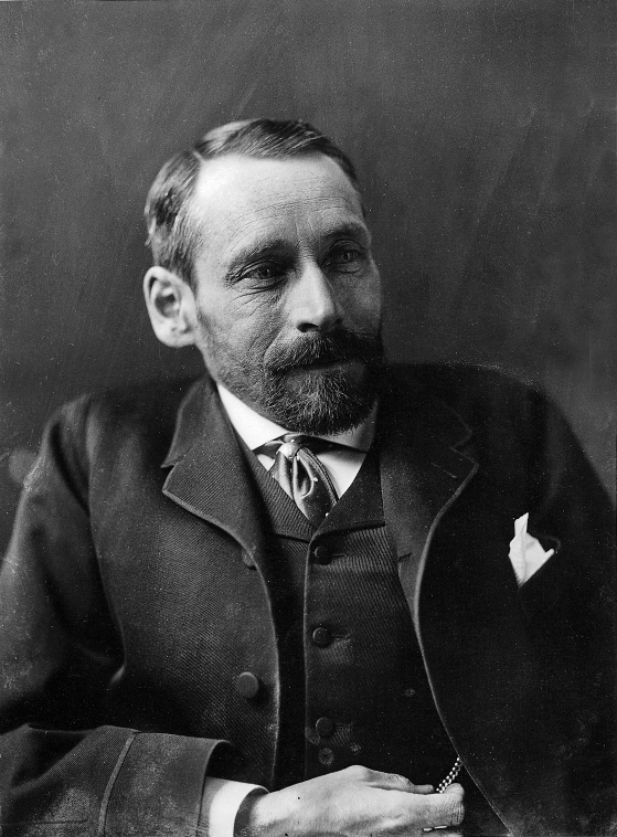
George Mercer Dawson (1849-1901) wanted to be a ‘natural scientist’, and he most certainly achieved his ambition. When he was five his family moved from Nova Scotia to the slopes of Mount Royal where his father was principal of fledgling McGill College (later University).
Intensely inquisitive about the natural world, young George yearned to be outside but tuberculosis of the spine kept him bed-ridden, and left him a crippled hunchback. He persevered, graduating at the top of his class at the Royal School of Mines (later Imperial College, London) in 1873 and was hired as the naturalist-botanist for the British North America Boundary Commission (1872-1876).
His Report on the Geology and Resources of the Region in the Vicinity of the 49th Parallel established his reputation as a keen observer and dedicated field-man, on horseback, by canoe and on foot.
Hired by the Geological Survey of Canada (GSC) as a paleontologist on July 1, 1875, Dawson’s fieldwork ranged over the western region of the new Dominion of Canada. He was among the first to use a portable camera to augment his notes. Many of these photographs are now valuable historical records.
He reported on the geology of the Kootenay region, emphasizing their mineral potential. In 1878 he surveyed the geology and ethnography of the Queen Charlotte Islands, describing the customs of the Haida people before imported disease ruined their way of life.
In 1879 and 1880 he mapped the prairie lands of the lower Peace and Athabaska rivers, noting its potential for agriculture.
When systematic geological mapping began in 1881 he was responsible for the Rocky Mountain Front Ranges from the 49th parallel, northward to the latitude of Kicking Horse Pass. Dawson named Mount Temple (near Lake Louise) and Mount Assiniboine during the course of his mapping.
The Yukon expedition of 1887 (maps 1 & 2) was mounted in response to:
- poorly-located reports of placer gold
- a clandestine American reconnoiter
- uncertainty in the location of the 141st meridian that separated the Alaska Purchase from Canada’s Northwest Territories.
Dawson’s task was to survey the course of seven wilderness rivers, following established un-mapped trails and abandoned fur trading routes.
During this 1300-mile circuit his party built their boats five
times using materials at hand.
He meticulously described the flow of rivers, plotting his position using a sextant and two chronometers, noting the rocks, plants, animals, and dialects of native inhabitants. Rumours of hostile natives and fearsome rapids were deflated by the expedition. The report encompassed almost everything known about the Yukon to that time.
Subsequently Dawson spent three field seasons in northern BC, received honorary doctorates from Queen’s and McGill, and was appointed to the Bering Strait Arbitration to settle a sealing dispute.
He became director of the GSC in 1895 and served as president of the Royal Society of Canada and the Geological Society of America in successive terms.
During his leadership, increasing demands were made of the GSC but its budget was steadily reduced; he strove valiantly to retain his underpaid staff. He died in office at age 52. The nation mourned the loss of a great scientist and dedicated public servant.
George Dawson never mentioned his obvious disfigurement -instead he was renowned as a cheerful companion, an indefatigable observer and a stickler for accuracy and lucid writing. He held high standards for precision in government geoscience.
His reports emphasized the practical utility of scientific data by placing them in the frame of potential economic value. He recognized aboriginal culture, recording the native names and customs without bias.
The esteem in which he was held led to his name being applied to new towns in the Klondike and the Peace River district (Dawson City, Yukon; Dawson Creek, B.C.). His maps, and three major reports – the last being A Geological Record of the Rocky Mountain region of Canada, published in 1901 – are fact-filled classics that remain vital historical documents, a lasting tribute to one of Canada’s greatest scientists.


