Project Description
ONTARIO
Northeastern Ontario Algonquin Park
PreCambrian Plate Tectonics and Pleistocene (Laurentide) Glaciation
Fieldwork by Alexander Murray
THE SCIENCE
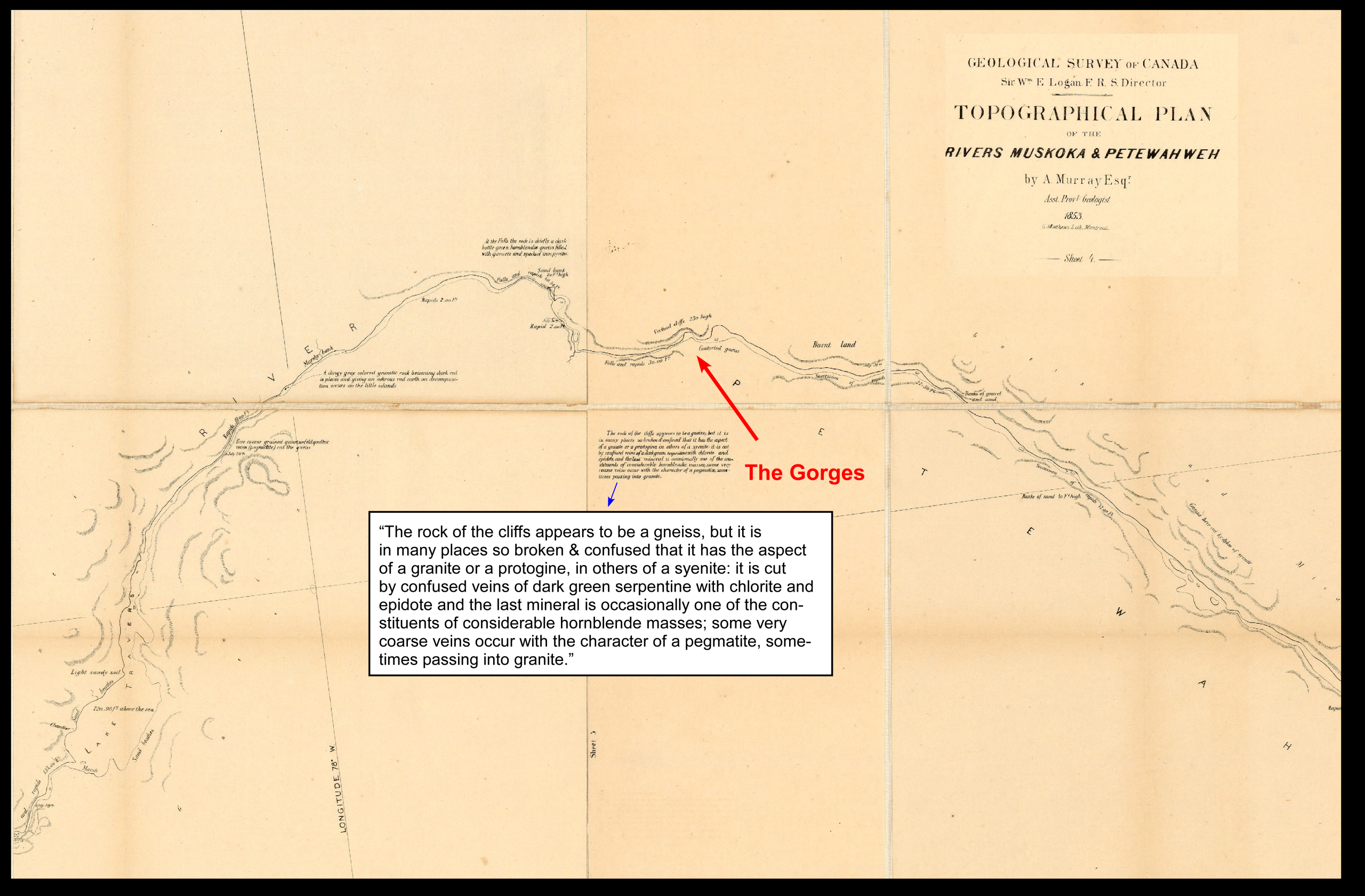
Murray and the Petawawa Gorges area (Algonquin Park)
Geologists are commonly some of the first to visit unexplored areas, whether it be Canada or the robotic geologists of the Rovers on Mars. The Algonquin Park area is no exception.
David Thompson, well known to westerners for his unprecedented and accurate maps of the Rockies, did basic mapping in Algonquin late in his life in 1837. Alexander Murray, at the age of 42 years old, was dispatched by Logan in 1853 to map the Huron Ottawa territory. He followed some of the same route travelled by David Thompson in 1837.
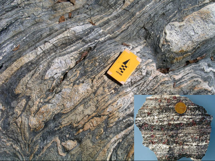
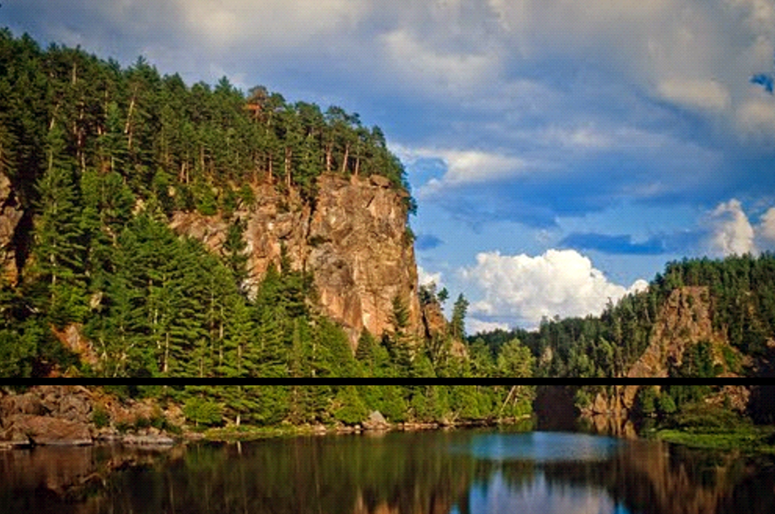
His notes comment on portions of the Petawawa River, similar to those captured by the artist Tom Thomson. “…the river…in some parts pent up in narrow gorges, it rushes on in violent rapids or tumbles in precipitous falls.” He describes the rocks as “for the most part micaceous and hornblendic gneiss, sometimes interstratified with …quartzose layers, which frequently hold small , pink garnets. The prevailing colour of the gneiss is red or grey…“
As George Garland comments in Glimpses of Algonquin, he reported only granitic gneiss, barren of mineralization, and this negative finding undoubtedly had the positive impact that the area was established as a park 40 years later thereby suspending further prospecting and allowing it to remain a wilderness.
Current Understanding – Petawawa Gorges – a tale of two creations over 1 billion years
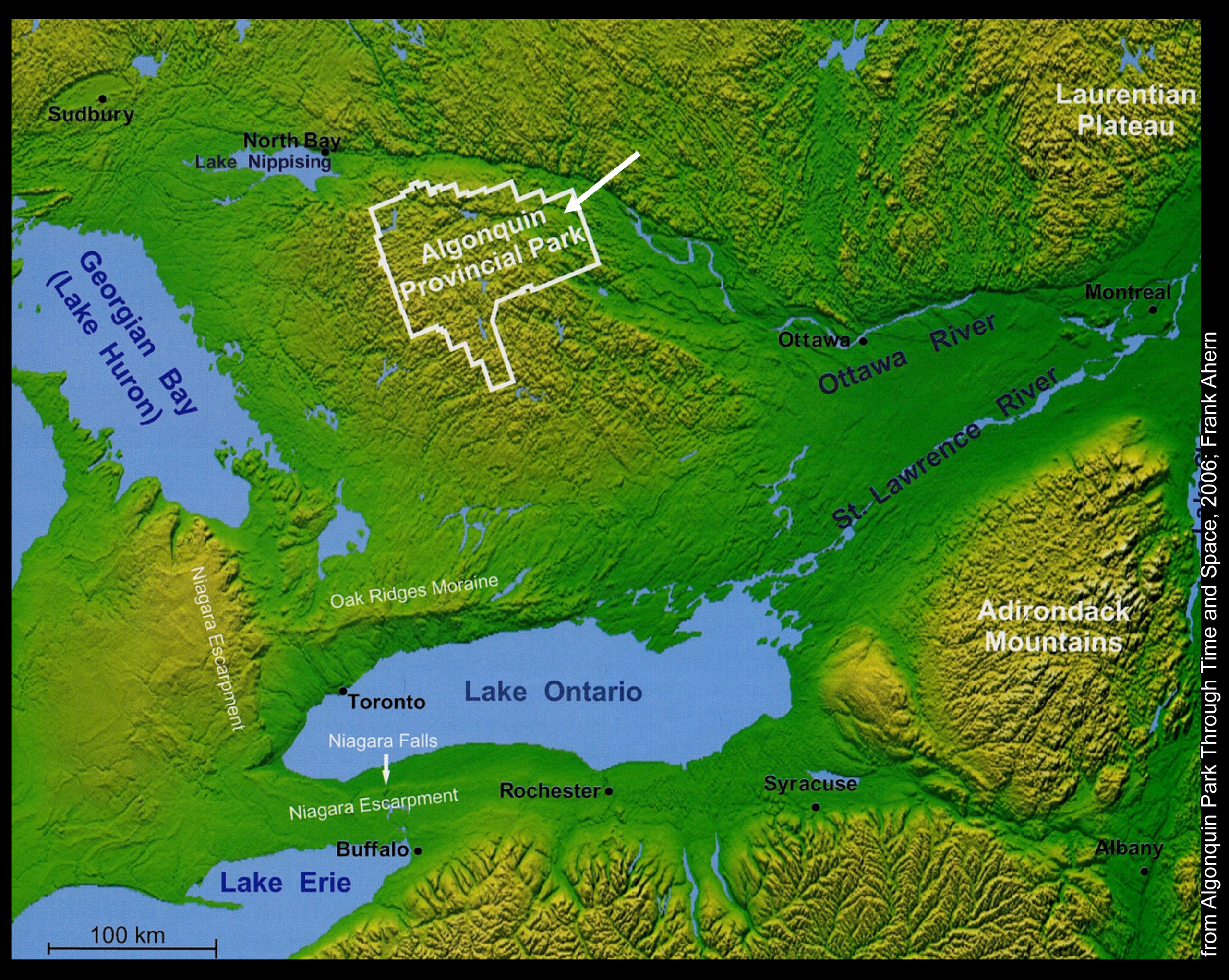
The Gorges of the Petawawa River occur in the northeastern corner of Ontario’s Algonquin Provincial Park (established 1893). The park is located over highlands which are the headwaters of many rivers that drain to the Great Lakes and the Ottawa – St. Lawrence Rivers.
The Gorges occur at the break between the highlands and the Ottawa River Valley. There are two intertwined stories of the creation of the Petawawa Gorges: the origin of the colourful rock of the Algonquin Highlands, known as gneiss, and the subsequent creation of the awe-inspiring cliffs of the gorges.
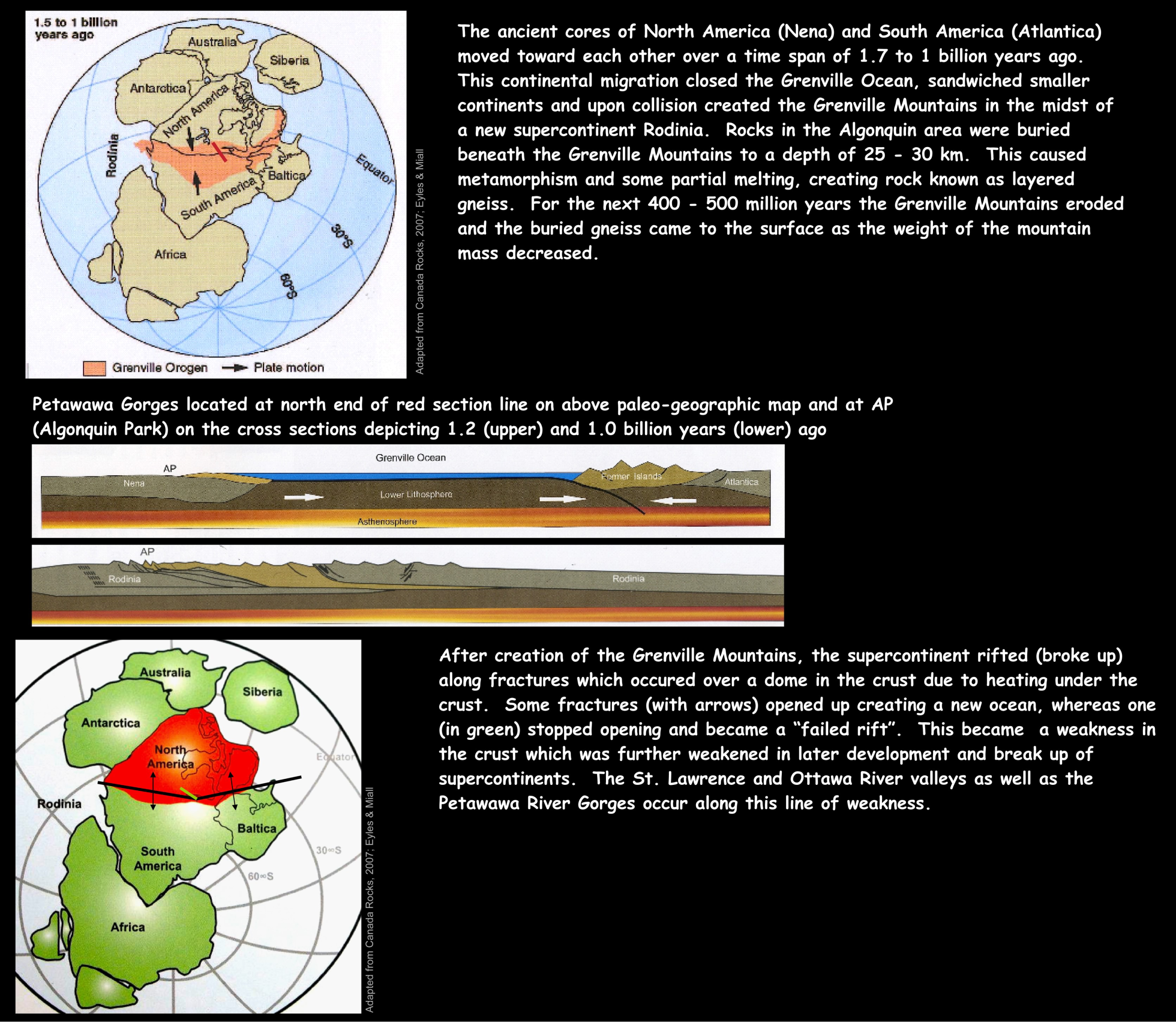
These are the features that attract so many including canoeists, adventurers, and artists such as the Group of Seven and Tom Thomson. The ancient cores of North America (Nena) and South America (Atlantica) moved toward each other over a time span of 1.7 to 1 billion years ago.
This continental migration closed the Grenville Ocean, sandwiched smaller continents and upon collision created the Grenville Mountains in the midst of a new supercontinent, Rodinia. Rocks in the Algonquin area were buried beneath the Grenville Mountains to a depth of 25 – 30 km. This caused metamorphism and some partial melting, creating rock known as layered gneiss.
For the next 400 – 500 million years the Grenville Mountains eroded and the buried gneiss came to the surface as the weight of the mountain mass decreased. After creation of the Grenville Mountains, the supercontinent rifted (broke up) along fractures which occured over a dome in the crust due to heating under the crust. Some fractures (with arrows) opened up creating a new ocean, whereas one (in green) stopped opening and became a failed rift.
This became a weakness in the crust which was further weakened in later development and break up of supercontinents. The St. Lawrence and Ottawa River valleys as well as the Petawawa River Gorges occur along this line of weakness.
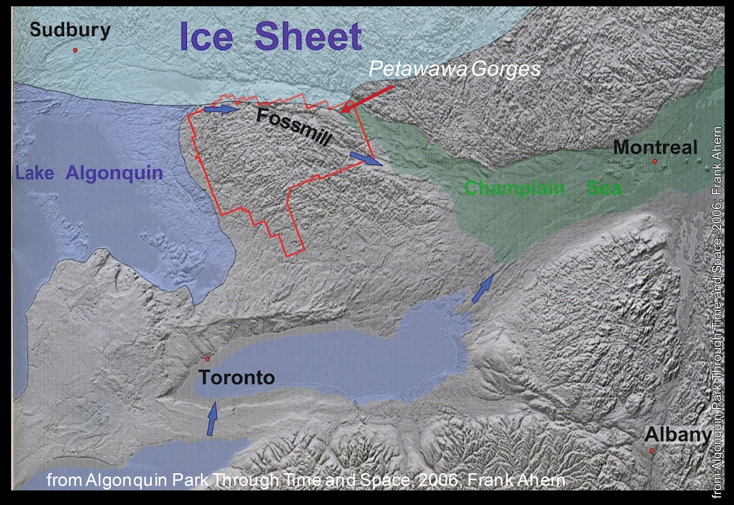
As the last glaciation of the current Ice Age was receding 11,000 years ago, water that was dammed at the ice front found its way along the lowland created by the line of weakness associated with the failed rift.
A large waterway known as the Fossmill Channel drained huge amounts of water from Lake Algonquin (its modern remnant being Lake Huron) to what would become the Ottawa River Valley, carving the gorges of the Petawawa River along its way.
The creation of the Petawawa Gorges has taken about a billion years and the landscape has changed dramatically over that time. The geological interpretation has also grown and evolved through time.
Alexander Murray’s first impressions established the rock type as ancient non-mineralized gneiss and recorded the awe-inspiring cliffs and gorges. In his time the notion of regional glaciation was just developing, and that of continents colliding and fragmenting with failed rifts was yet over 100 years away.
Acknowledgements and Selected References
Numerous geoscientists have contributed to the geological story presented here; far too many to acknowledge individually. Rather you are strongly encouraged to consult the publications that have been invaluable in creating this poster. Special thanks to and F. Ahern, N. Eyles, and A. Miall for permission to use their material and graphics for this outreach project.
- Reading the Rocks: the Story of the Geological Survey of Canada 1842-1972. Morris Zaslow Macmillan Co Canada 1975;
- Glimpses of Algonquin. compiled by G.D. Garland Friends of Algonquin 1989; Rock Ontario. Ontario Ministry of Northern Development and Mines Queens Printer for Ontario 1994;
- Algonquin Park Through Time and Space. Frank Ahern Warwick Publishing Inc. 2006;
- Ontario Rocks: three billion years of environmental change. Nick Eyles Fitzhenry & Whiteside 2002;
- Canada Rocks: The Geologic Journey. Nick Eyles and Andrew Miall Fitzhenry & Whiteside 2007

 Alexander Murray